
 Tamas Miklovicz
CHPM2030 project closure
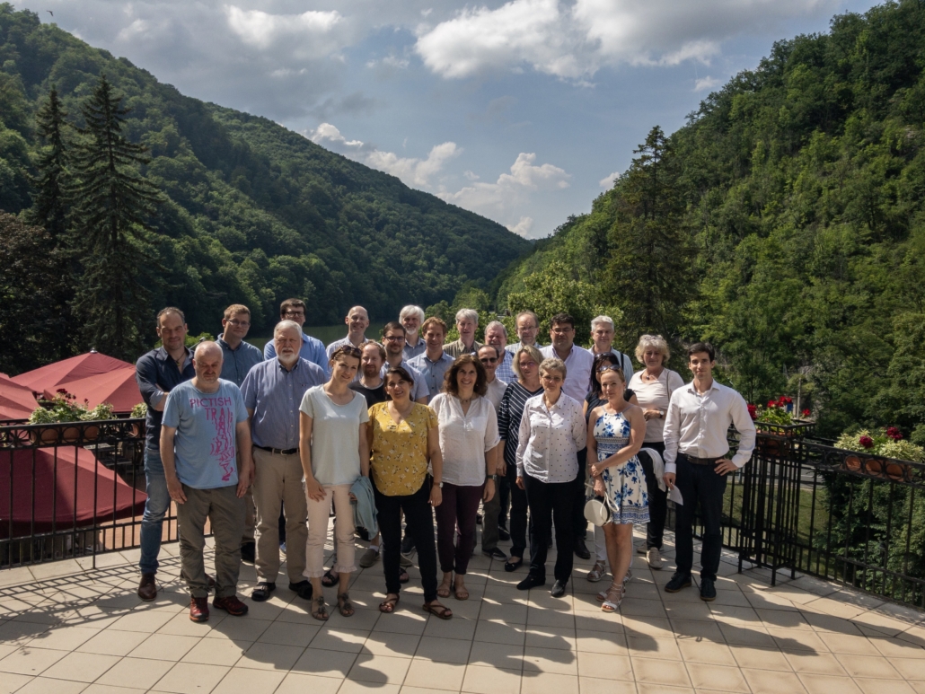
CHPM2030 Final meeting
The CHPM2030 project partners met in Lillafüred, Hungary, for the last Consortium meeting, hosted by the coordinator, University of Miskolc. On the first day the six WP leaders presented the final outcomes and the status of deliverables. Tamas Miklovicz from LPRC presented WP6 – Roadmapping and preparation for pilots and the CHPM Roadmap and recommendations for future research projects (view Prezi slideshow here). Two brainstorming sessions were held, with similar aims: on the first, Tamás Madarász, coordinator from UNIM, facilitated a discussion regarding “Potential for follow-up; How to proceed?”, and the partners discussed each technological components and evaluated whether it shall proceed as a complete CHPM look or as individual components, considering opportunities and threats. The second session was about “Preparation for the pilots, potential funding sources, future projects”. It reviewed each work packages within the project for ideas, funding opportunities, research topics, and the continuation of CHPM technology. Project reporting and financial issues were also discussed in the afternoon.


On the second day, the partners visited the Miskolc geothermal district heating system and its infrastructure (offices, heat exchangers, production/injection wells). The host, PannErgy, introduced the geological, geothermal and engineering aspects of the system.
As of June 30th, the working period of the project officially finished, and now the team is working on the project technical and financial reporting. LPRC is responsible to provide the technical reporting of the whole of WP6.
The objectives of WP6 – Roadmapping and preparation for pilots
The CHPM technology is a low-TRL, novel and disruptive but fragile idea, that needs further nurturing and future oriented thinking. Work Package 6 represents these forward-looking efforts and aims to set the ground for subsequent pilot implementation by working on three interlinked areas: mapping convergent technology areas (linked to CHPM exploration, development, operation and market), study potential pilot areas and develop future research roadmaps.These three areas are grouped under the WP6 subtasks: Task 6.1 Horizon scanning & Visions; Task 6.2 Preparation for pilots; Task 6.3 Roadmapping. The work of WP6, including the 3 sub-tasks has been implemented thanks to the coordination and facilitation of LPRC, with the involvement of all Partners, Advisory Board members and external Experts. WP6 ran since December 2017.
Task 6.1 Horizon Scanning and Visions
Recently, the two main activities in this task were: the 2nd round of the CHPM2030 Delphi survey and the Visioning workshop.
The Delphi survey was a 2 round, expert input based foresight tool, that was completed by 133 participants, worldwide. All Partners received and completed both rounds. Partners, especially EFG and UNIM, used their professional network and channels (website, social media, newsletters) to invite participants. The survey built on the results of the Horizon Scanning exercise, and the 2nd round incorporated the results from the 1st, so participants could re-evaluate their feedback. The survey provided insight about important, but uncertain areas in the future, while mapping convergent technology areas and emerging issues. The results have been processed by LPRC, and were used to define discussion topics and issues for theVisioning workshop.


")

")
The CHPM2030 Visioning workshop brought together Consortium partners (ISOR, VITO, KUL, UNIM, EFG, LPRC (methodology & host), BGS) and external Experts (industry, academia), from both geothermal and mineral sectors. The participant selection was based on constructive contribution in the Delphi survey, and partner’s recommendations. The one-day workshop included an introduction with presentations, two group sessions and a plenary. The group sessions focused on setting up targets related to already identified aspects of the technology (exploration, development, operation, market), based on previous results and expert judgement. The last session was about consensus building, where the facilitators presented the group’s results and an agreement was formed about the established targets.
The results from the Horizon Scanning exercise, Delphi survey and Visioning workshop have been processed and synthesized into Deliverable 6.1 Report on Emerging and Converging technologies, related to the future of CHPM technology.
Task 6.2 Preparation for pilots
This subtask had three activities in the recent period: finalising the evaluation template, evaluating study areas, and creation of an EU spatial database on prospective locations.
The first step for this task was the creation of the evaluation template (with the help of BGS, LNEG, IGR, SGU, UNIM, facilitated by LPRC) through online meetings, email communication, field trips and a workshop. This served as a “checklist” for important characteristics to consider when looking into CHPM potential. During the creation of the evaluation strategy, a field trip in Romania was organised by IGR (BGS, UNIM, LPRC, participated), following the previous Cornwall field trip (22-24th of May 2018) organised by BGS. A strong emphasis was given to 3D modelling and to compile all available geological information at one place for reinterpretation.
The 5 study areas from 4 countries have been evaluated according to this new strategy, investigating the CHPM potential. With the help of these study reports and the European outlook study, the following items have been clarified: 1) the information available at each area, 2) the CHPM potential based on this geoscientific data, 3) remaining gaps to be overcome in the future. The evaluated areas are Cornwall in South West England by BGS, Portuguese Iberian Pyrite Belt by LNEG, Beius Basin and Bihor Mountains in Romania by IGR, Nautanen and Kristineberg in Sweden by SGU.


The 5 study areas from 4 countries have been evaluated according to this new strategy, investigating the CHPM potential. With the help of these study reports and the European outlook study, the following items have been clarified: 1) the information available at each area, 2) the CHPM potential based on this geoscientific data, 3) remaining gaps to be overcome in the future. The evaluated areas are Cornwall in South West England by BGS, Portuguese Iberian Pyrite Belt by LNEG, Beius Basin and Bihor Mountains in Romania by IGR, Nautanen and Kristineberg in Sweden by SGU.
The British Geological Survey staff (Paul A J Lusty, Richard B Haslam, Richard A Shaw, Eimear A Deady, Paul Williamson) produced a c. 160 page detailed report on SW England. This worked with information sources reported in WP1, and also new information coming out of the ongoing geothermal investigations in SW England (e.g. the United Downs Deep Geothermal Power project, and also the GWatt project). A detailed reappraisal of the data was undertaken. In summary, the report considered the availability of geoscience information, the geological environment, geothermal characteristics, potential for deep metal enrichment, and technical, environmental, social and regulatory factors that could influence the future development of CHPM extraction technology in the region. Preliminary modelling of the Cornubian Batholith has been undertaken to improve understanding of its properties relevant to geothermal energy development. A regional model was constructed to understand the spatial relationship of key geological parameters. These data was used for the development of two site-scale models that aimed to improve understanding of the fracture network and flow pathways at the reservoir-scale. South-west England, and specifically Cornwall, is an excellent location for a pilot-scale CHPM system.
The report on the Portuguese Iberian Pyrite Belt (~50 pages), prepared by the Portuguese National Laboratory of Energy and Geology (Elsa Cristina Ramalho, João Xavier Matos, João Gameira Carvalho), evaluated the Variscan metallogenic province, massive sulphide deposits, prospect for deep mineralization for CHPM potential. The study area report provided an update on the geoscientific data and information on SW IPB, 3D modeling (focused on the Neves-Corvo Mine) and geophysical data. The future research programmes should investigate the deeper ore deposits, with 3D/4D modeling, new deep seismics, 3D electromagnetic forward modeling and 3D inversion. The Lombador orebody, which is present at 2-3 km, has the potential to extend the lifetime of the mine with CHPM technology. Strong cooperation with the mining company that is exploiting the mine and the Portuguese government is recommended.
The report from Romania (~80 pages), developed by Geological Institute of Romania (Diana Perșa, Ștefan Marincea, Delia Dumitraș, Cătălin Simion), provided information about the CHPM potential of the Beius Basin (up and running geothermal heating system, Mg skarns, high geothermal potential), and the Bihor Mountains (granodiorite- granite plutonic body related, skarn (Fe, Bo, Bi, Mo, W), vein (Cu, Zn, Pb, sulphides). IGR has also developed a new 3D geological model, compiling all available geoscientific information of the study area. The future recommendations on this area describe new geothermal models (150 Celsius), refraction seismic for the plutonic body and mineral indications and fracture network modeling for understanding reservoir characteristics.
The Swedish report (~70 pages), delivered by Geological Survey of Sweden (Gerhard Schwarz, Benno Kathol, Magnus Ripa, Bo Thunholm, Edward P Lynch, Johan Jönberger), described 2 ore provinces: Kristineberg area (Skellefte district, volcanogenic massive sulphide deposits, Zn, Cu, Au), and Nautanen area (Northern Norrbotten district, IOCG, Cu, Fe, Au). The challenges here are the low geothermal gradient, limited information at 5-7 km depth, low permeability and hydraulic conductivity and lack of information about deep-seated fluids. It is recommended that future exploration includes identification of metal bearing formation at crustal depths (seismic velocities, electrical resistivity), 3D/4D modelling, stimulation, involvement of the mining industry and ER regional development funds, achieving public acceptance, among others.
Besides evaluating concrete study areas, the European Federation of Geologist (Domenico Marchese, Anita Demény, Isabel Fernandez) led the European outlook for prospective locations, with the help of the its National Associations that are involved in the project as Linked Third Parties (LTPs). In total there were 24 countries covered: Belgium, Czech Republic, Finland, France, Germany, Greece, Hungary, Ireland, Italy, Netherlands, Poland, Portugal, Serbia, Slovenia, Spain, Switzerland, Ukraine, Austria, Croatia, Cyprus, Luxembourg, Slovakia, Sweden, the United Kingdom. Each National Association had 3 tasks: 1) Area selection: definition of areas most likely to be a future CHPM candidate; 2. Basic area evaluation: the task continued with the evaluation of the basic characteristics of the selected areas; 3) CHPM characteristics: this task considered a deeper investigation and data evaluation of the most likely CHPM sites. EFG and LPRC provided instructions and templates for the LTPs and organised an orientation workshop, so they were full up to date with the task. Through continuous communication with the LTPs, EFG collected the 3 reports for most countries, describing the 3 tasks mentioned above. The result is a selection of areas that has potential for future CHPM application, which has been uploaded to a publicly available spatial database: http://bit.ly/CHPMinfoplatform.
Task 6.3 Roadmapping
This subtask had three future-oriented activities related to 2030 and 2050 time horizons, building different layers of the CHPM roadmap: 1) CHPM component roadmap, 2) Preparation for future Pilots, 3) Overall concept of CHPM. The objective of Task 6.3 was to provide a timeline and direct support for the implementation of CHPM and support breakthrough research. These activities were building on the results of the Task 6.1 and 6.2 and all Partners, AB members and external Experts have been involved in this process. Each layer provided recommendations about how to advance the area and support future pilot implementation.
The “CHPM component roadmap” provides a direct follow-up of the current technological components, by describing the state-of-the-art (2019: current state of the component, achievements, results during the project, referenced to the relevant deliverable), immediate research plan (2025: next actions, targets to continue the research on the technological component after the project), pilot research plan (2030: requirements of the component before integrating it into a CHPM pilot application), and long term objectives (2050: requirements of the component before integrating it into a CHPM commercial application). The technological components and the researchers working on the roadmap are the following: Integrated reservoir management (Szanyi János, Máté Osvald, Tamás Medgyes, University of Szeged); Metal content mobilization using mild leaching (Christopher Rochelle, BGS); Metal content mobilization with nanoparticles (Steven Mullens, VITO); High-temperature and high-pressure (HTHP) electrolytic metal recovery (Ramasamy Palaniappan, Jan Fransaer, KU Leuven, Xochitl Dominguez-Benetton, VITO); Metal recovery via gas-diffusion electrocrystallization (GDEx), (Xochitl Dominguez-Benetton, VITO); Salinity-gradient power by reverse electrodialysis (SGP-RE) (Joost Helsen, VITO); System integration (Árni Ragnarsson, ISOR).


The “Preparation for future pilots” study investigated the pathway to pilot implementation by 2030, by providing a detailed area description and future recommendations. This task was completed at 5 areas in Europe by their representing partner (Cornwall by BGS, Iberian Pyrite Belt by LNEG, Beius Basin/Bihor Mountains by IGR, Kristineberg and Nautanen by SGU). The recommendations covered 1) future exploration plans for the technological components (getting new geoscientific information, exploration methods and tools to obtain relevant information regarding the technological components (outlined in the evaluation template), 2) funding opportunities (EU funds projects, PPP, private investors, other financing) and 3) Stakeholder engagement (involved parties, end users, stakeholders, policy and regulatory issues).


“Overall concept of CHPM” study investigated the feasibility of combining geothermal energy and mineral extraction with the use of foresight tools such as Horizon Scanning, Delphi survey and Expert workshops. The emerging issues were split into four main themes (CHPM exploration, development, operation, market). These topics and their subtopics were delivered and refined through the foresight exercises in WP6.


The Roadmapping workshop was the continuation of the Visioning workshop with the involvement of the Consortium partners and external Experts. The main task of the group work were the validation of previously identified targets (vision) and the backcasting exercise itself (actions). After the workshop, LPRC processed the results, and presented the findings in D6.3, a document about the recommendations on targets, actions, signposts, wildcards linked to exploration, development, operation, and market, including a visualisation for each theme.
The CHPM WP leaders are going to meet one more time at the project review meeting at GeoHub, Brussels in the end of August.
Download and read our reports under the following buttons.
 VAMOS project


 La Palma Research Centre
 AGEO
AGEO